Seattle tram map
You can find on this page the Seattle tram map to print and to download in PDF. The Seattle trams map presents the network, zones, stations and different lines of the tramway of Seattle in Washington - USA.
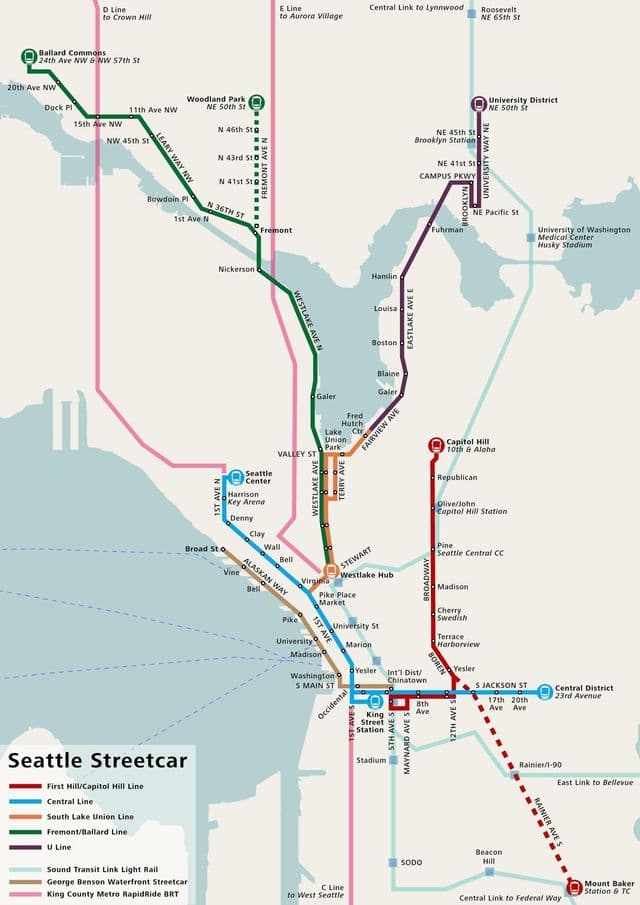
Seattle tramway map
The Seattle tram map shows all the stations and lines of the Seattle tramways. This tramway map of Seattle will allow you to easily plan your routes in the trams of Seattle in Washington - USA. The Seattle tram map is downloadable in PDF, printable and free.
Seattle tram travel on the streets, but on rails, kind of like a cross between light rail and buses. Seattle has just two streetcar lines, one in South Lake Union (with stops throughout South Lake Union, Denny Triangle, and McGraw Square) and one in First Hill (with stops in Capitol Hill, First Hill, Yesler Terrace, Central District, the International District, and Pioneer Square as you can see in Seattle tram map. These are great if you are staying near one of the lines and need a way to hop around the neighborhood. Seattle first electric streetcars opened in 1889 and by 1892, the city had 48 miles of electric streetcars and 22 miles of cable railway. In 1902, the Seattle-Tacoma Interurban Railway opened, which includes stops in Rainier Beach, Renton, and Kent. And by 1910, a Mount Vernon-to-Bellingham line opens.