Seattle topographic map
You can find on this page the Seattle topographic map to print and to download in PDF. The Seattle elevation map present the topography, river and relief of Seattle in Washington - USA.
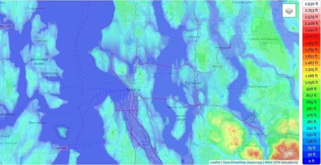
Seattle elevation map
The Seattle topographic map shows elevation, hills and landforms in Seattle. This elevation map of Seattle will allow you to know topography, river and relief of Seattle in Washington - USA. The Seattle topographic map is downloadable in PDF, printable and free.
The latitude and longitude coordinates (GPS waypoint) of Seattle are 47.6062095 (North), -122.3320708 (West) and the approximate elevation is 177 feet (54 meters) above sea level as its shown in Seattle elevation map. Many major cities around the United States, especially those that are situated in coastal locations like Seattle, tend to have quite low elevations as they are so near the sea. This is true of places like New York City and Los Angeles for example. Back in the state of Washington, the highest town is Waterville, located in Douglas County and sitting at an elevation of 2,622 feet (799 m), and the state itself has a mean elevation of 1,700 feet (520 m), so Seattle elevation is much lower than the state average.