Seattle streets map
You can find on this page the Seattle streets map to print and to download in PDF. The Seattle roads map presents the road network, main roads, routes and motorways of Seattle in Washington - USA.
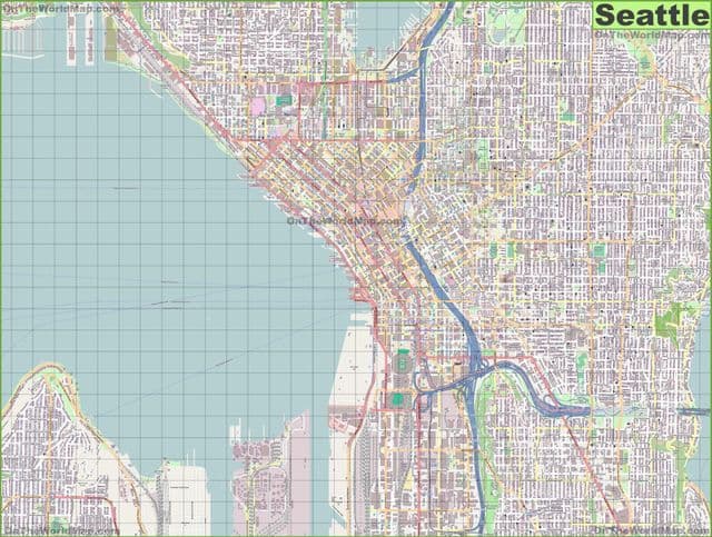
Seattle streets map
The Seattle streets map shows all street network and main roads of Seattle. This streets map of Seattle will allow you to find your routes through the streets of Seattle in Washington - USA. The Seattle streets map is downloadable in PDF, printable and free.
Up on Capitol Hill, Broadway runs from Volunteer Park all the way to Yesler Way. Hosting both Seattle University and Seattle Central College, Broadway is one of the main thoroughfares for the area. Chosen for the Capitol Hill stop along the Light Rail, Broadway was also recognized as the most logical destination for the relatively recent Seattle Streetcar. Stretching south from Olympic Sculpture Park all the way to Pioneer Square, Alaskan Way brings its voyageurs along the Seattle Waterfront. Other than providing exceptional views of Elliott Bay and the Olympic Mountains, the street—which is also great for cycling—provides access to Ye Olde Curiosity Shop, the Seattle Aquarium, the Seattle Great Wheel, and the Colman Dock, where people can catch ferries across Puget Sound and beyond (see Seattle streets map).
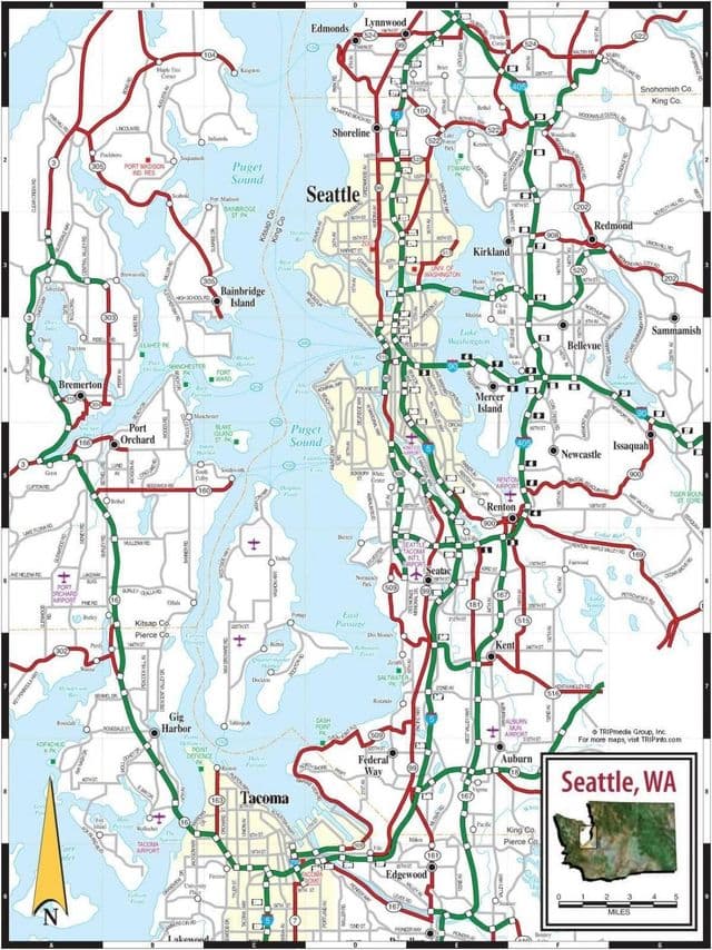
Seattle roads map
The Seattle roads map shows all road network and highways of Seattle. This roads map of Seattle will allow you to find your routes through the roads and motorways of Seattle in Washington - USA. The Seattle roads map is downloadable in PDF, printable and free.
Driving in Seattle, Washington, can be challenging—rain, rush-hour traffic, temporary HOV lanes, one-way downtown streets, hard-to-navigate hills, and unexpected toll roads add to the confusion (see Seattle roads map). Seattle has managed to land itself on a few lists, and it regularly appears among the cities with the worst traffic in the country. Seattle has a ton of bicyclists, many of whom are responsible and obey the biking rules of the road, some of which may be confusing to motorists. City and residential-area streets alike often go from one to two lanes. Sometimes streets have room for parking and a single lane of driving but might look suspiciously like a two-lane road. Many quaint and historic neighborhood streets in Seattle will have cars parked on both sides of the road, which turns a two-way street into a single-lane street with room for one car at a time.