Seattle bus system map
You can find on this page the Seattle buses map to print and to download in PDF. The Seattle bus system map and the Seattle trolley map present the network, stations and lines of the buses and trolley of Seattle in Washington - USA.
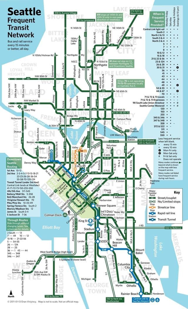
Seattle bus map
The Seattle bus map shows all the stations and lines of the Seattle bus system. This bus map of Seattle will allow you to easily plan your routes in the buses of Seattle in Washington - USA. The Seattle bus system map is downloadable in PDF, printable and free.
Seattle Metro bus and electric trolley system covers all of greater Seattle. Fares are based on zones and travel time. Off-peak fares for all zones are $2.25 for adults, $1.25 for ages 6–18. During peak commuter hours, adult fares go up to $2.50 for 1 zone, $3.00 for 2 zones; senior and children fares remain the same. Use exact change and pay on the bus. Sound Transit operates two express bus routes that pickup and drop off passengers at the sound end of the main terminal on our lower drive. The ST Route 560 serves Burien, Renton, and Bellevue, WA. The ST Route 574 heads south and connects passengers with Federal way, Tacoma, and terminates in Lakewood, WA as you can see in Seattle bus map.