Seattle bike map
You can find on this page the Seattle bike map to print and to download in PDF. The Seattle bicycle map presents the bike routes and lanes of Seattle in Washington - USA.
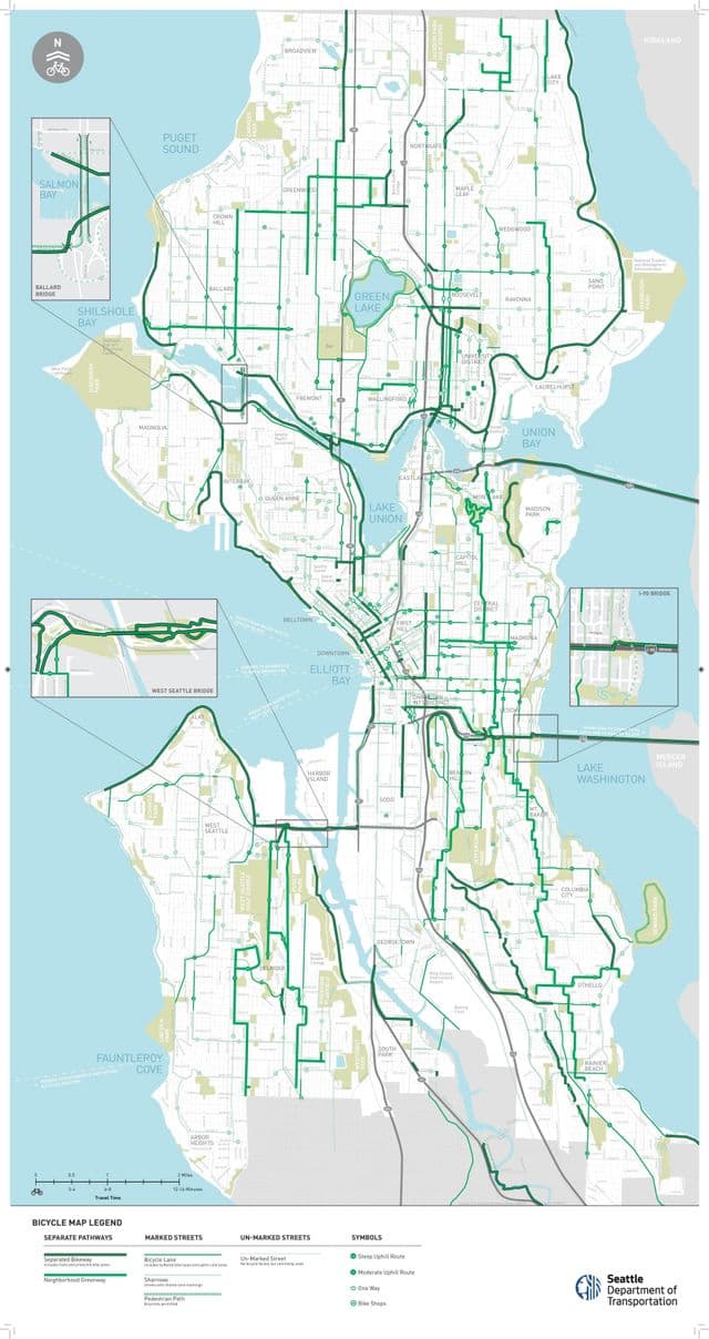
Seattle bike lane map
The Seattle bike lane map shows all the bike routes of Seattle. This bicycles lanes map of Seattle will allow you to easily plan your routes with a bike in Seattle in Washington - USA. The Seattle bike lanes map is downloadable in PDF, printable and free.
Seattle is a bike-friendly city. If you are visiting, it is easy to find a ride no matter where you are. Open your Uber app and select the Bike option from the top menu to quickly and easily reserve a nearby JUMP bike. All bikes are dockless and include an electric assist that provides a boost up to 15mph. JUMP bikes are free to unlock and charge $0.15 per minute (see Seattle bike lane map). Another app-based, bike-share service is Lime, offering both e-assist and pedal bike options throughout Seattle. Simply download the app and scan the QR code to unlock a bike for only $1, plus varying rates per minute. Sodo Trail, short, but useful trail that runs next to the light rail and allows you to bypass the busy roads and crappy pavement. Useful for getting to the stadiums from the south, easy access to the light rail.